Extract Curb

The Extract Curb command can automatically create curb polylines when the user traces a line along the edge of the road, or inputs a centerline via a .cl file. 
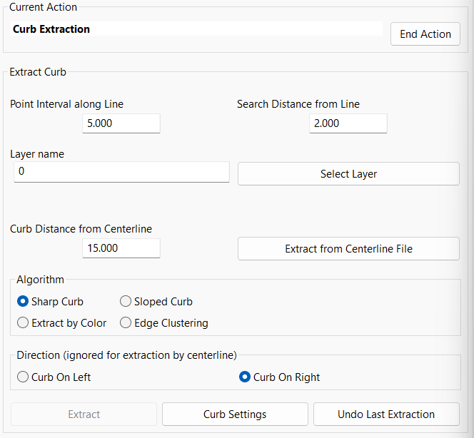
Note: before running this command, go to Selection > Add > Perimeter Inside and draw around the area where this feature will be used. Ensure to choose a good number of points on either side of the curb.

Extract Curb Panel

Point Interval along Line is how far the program will go along the user's line, between attempts to create a set of curbline points. 

Search Distance from Line is how far from the user's line, the program will look for a curb edge. 

When extracting by centerline, two extraction lines are created, at the distance from the centerline set by the user. 

The Sharp Curb and Sloped Curb algorithms both operate via a profile generated from the locations of the cloud points.  So they work best on clouds where the curb shapes are clear. 

Extract by Color will find a boundary between colors, for example between the road and the grass.  This is recommended over the other algorithms for use with clouds generated by photogrammetry. 

Edge Clustering is a new feature in Carlson 2022 which uses typical heights of the curb. Use the Selection process mentioned above before running this command. Click on Extract then choose either English, Metric or Custom. The default value of 25 for the Min Curb Point Count normally works well. When it's run, it will look for all the top of curb and bottom of curb points then looks at the edges and draws them.

The Direction setting assumes that the user's line is drawn in the street from bottom to top of the view.  The direction chosen should be away from the street. 

The curb settings define where the auxiliary curb polylines are drawn, relative to the main curb polyline.  If curb heights are set too high or too low, extraction might fail. 

The undo button will remove all polylines created by the last curb extraction. 

Converted from CHM to HTML with chm2web Standard 2.85 (unicode)