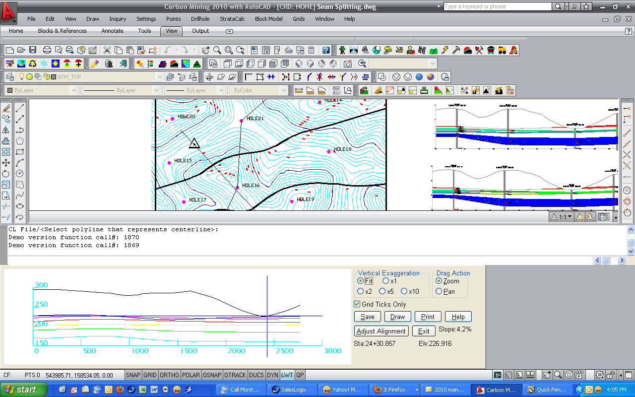
Quick Fence is very similar to Quick Profile, in that an instant
profile appears at the bottom of the screen, displaying the
surfaces. This fence alignment can be set by picking points,
selecting a centerline file, or selecting a polyline from the
screen. A triangle appears in the plan view as the cross hairs are
moved along the fence diagram below. This displays where along the
fence line the cross hairs are. The slope of the surface, the
station and elevation appear dynamically below the buttons. The
Adjust Alignment function allows you to drag a horizontal alignment
point and update the fence diagram in real-time for quick and
efficient grid model verification. It is important to note that
this command can only be used with Elevation-based geologic model
files. Thickness-based geologic models cannot be used.
Select the Geologic Model File (*.PRE)
Pick starting point (CL-Centerline,P-Polyline): p if the polyline is drawn on
screen
Polyline should have been drawn in direction of increasing
stations.
CL File/<Select polyline that represents centerline>:
select the polyline
Drop-Down Menu Location: under StrataCalc
Keyboard Command: qfence
| Converted from CHM to HTML with chm2web Standard 2.85 (unicode) |