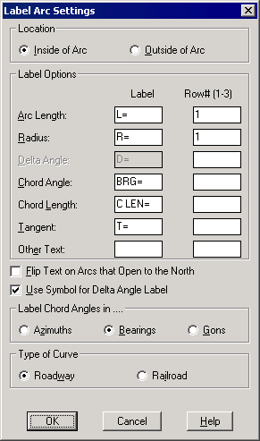
This command labels the arc data along the arc and between the endpoints of the arc. The curve information is also displayed. Carlson Survey plots the annotation as a block. The advantage of this is that the characters, rather than being individual entities, are plotted as a single entity that can be moved and edited as a unit. The format for the label is set in the following dialog box.
Under
Location, the placement of the text is determined.
● Inside of Arc: The arc is
labeled on the inside.
● Outside of Arc: The arc is
labeled on the outside
Under
Label
Options, the text and row locations are set. If a row number is left
blank, then that value is not labeled.
● Arc Length: Select a
label prefix and a row number.
● Radius: Select a label prefix
and a row number.
● Delta Angle: Select a label
prefix and a row number.
● Chord Angle: Select a label
prefix and a row number.
● Chord Length: Select a label
prefix and a row number.
● Tangent: Select a label prefix
and a row number.
● Other Text: Enter any other
item you want labeled.
The
Flip Text
on Arcs that Open to the North determines whether to flip the text on
arcs that open to the top of the drawing. An example is seen
below.
4 The Use symbol for Delta Angle option uses a delta triangle symbol for the prefix.
5 Label Chord Angles In allows you to set how the angle is labeled.
● Azimuth: The angles are reported as azimuths.
● Bearings: The angles are reported as bearings.
● Gons: The angles are reported as gons.
6 The Type of Curve option determines the type of curve.
● Roadway: The length is determined as the true length of the curve.
● Railroad: The length is adjusted based on 100-foot chord segments.
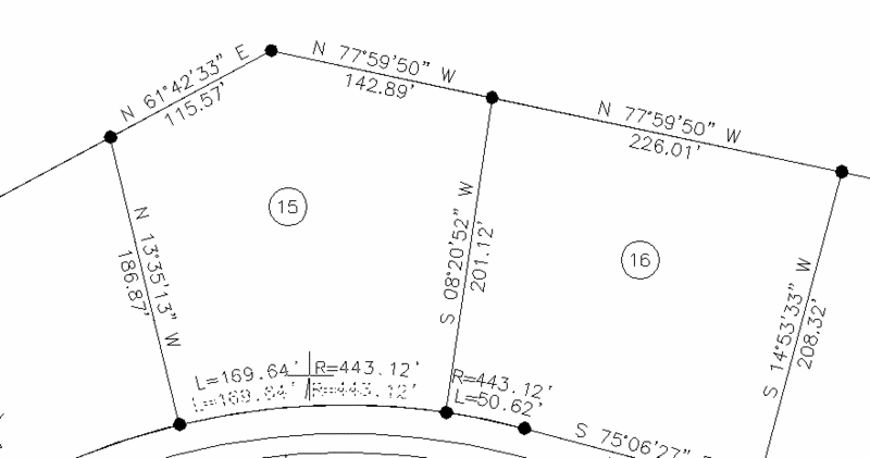
1 Define arc by, Points/<select arc or polyline>: select arc
After you select the arc or polyline arc segment, the command displays the dialog box. Select the OK button and the arc is labeled with the current settings of the dialog box.