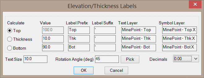
Calculate: This option controls which values will be
entered and which value will be calculated. If this option is set
to "Top", then the value for the Top Elevation will be
automatically calculated based on the values for the Thickness and
the Bottom Elevation.
Value: These are the values that will be labeled.
Label Prefix/Suffix: These fields control the label
prefixes and suffixes, as shown in the below image.
Text/Symbol Layer: These fields set the layers for the
symbols and the labels.
Text Size: This value sets the text size for the labels.
All three labels will be the same size.
Rotation Angle (deg): This value sets the rotation angle
(in degrees) of the labels and the symbols. Clicking the
Pick button will prompt you to pick two points on the screen
to set the rotation angle.
Decimals: This dropdown list controls the number of
decimals to label.
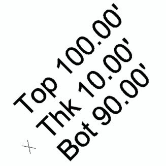
The below image shows the symbols and text that will be drawn using the settings shown in the above dialog.
Pulldown Menu Location: Notes
Keyboard Command: minepoints