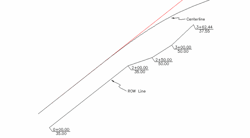
This command adds right of way information to a centerline file which must be created before running this command. The right of way is created by entering station-offset points or picking points. A right of way polyline is drawn through the points and each point is labeled with the station and offset. Besides drawing the right of way, this data can also be used in Process Road Design to limit the cut/fill slopes.
Choose Centerline to Process Specify a centerline
file.
Layer name for labels <ROW>: press Enter
Number of decimal places for labels <2>: press
Enter
Side for right of way (Left/<Right>)? press
Enter
Starting station of centerline: 0.000
Enter station or pick a point ('U' to Undo, Enter to End):
0
Enter offset: 35
Enter station or pick a point ('U' to Undo, Enter to End):
200
Enter offset: 35
Enter station or pick a point ('U' to Undo, Enter to End):
250
Enter offset: 50
Enter station or pick a point ('U' to Undo, Enter to End):
300
Enter offset: 50
Enter station or pick a point ('U' to Undo, Enter to End):
pick a point
Enter station or pick a point ('U' to Undo, Enter to End):
press Enter
The end result is a new polyline and a fully annotated ROW
line plot. The Enter ROW command can be used to create new
polylines that can be applied to templates using the command
Template Point Centerline.
Pulldown Menu Location: Centerline
Keyboard Command: rowentry
Prerequisite: A centerline file