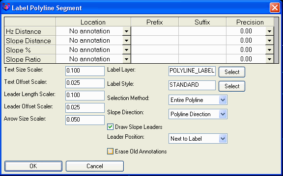
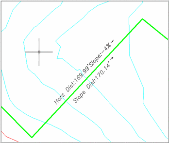
This command labels the distance and slope of 3D polyline segments, or between two picked points, in plan view.
In the dialog, choose the selection method; either the Entire
polyline, Polyline segment, or Any two points. Then choose the
location and/or visibility for the Horizontal distance, Slope
distance, Slope %, and Slope ratio, enter any desired Prefixes
and/or Suffixes, and the desired decimal Precision for each. Choose
whether to Draw Slope Leaders, which are arrows pointing in the
direction of the slope. The Slope Direction controls whether to
draw the slope leaders in the direction of the polyline, always
pointing uphill or always pointing downhill. Leader Position
controls whether to draw the slope leaders alongside the slope
label or above the label. Choose whether to Erase old annotations,
and set the Text size scaler, Text offset scaler, and other related
variables. Scalers are multiplied by the drawing scale to
determine the actual sizes for the specified objects. Choose the
Annotation layer from the drop list. Pick OK, and you are prompted
to select the polyline or segment or two points to
annotate.
Set up variables as desired in Annotate polyline dialog box,
pick OK. Depending on your Selection method, the prompt will
either read:
Select a polyline segment to
annotate: pick the
segment
or
Select a polyline to annotate: pick the polyline
or
Pick first point: _nea
to For snap on.
Pick second point:
_nea to
Press enter to return to the Annotate polyline dialog box, in
the dialog box, pick Cancel to end.
Pulldown Menu Location:
3D Data >> Label Polylines
Keyboard Command:
label3dp
Prerequisite: A 3D
polyline