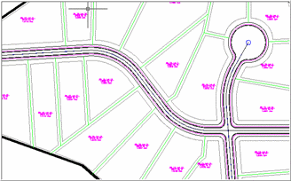
 Small Subdivision
Design with Roads and Lots
Small Subdivision
Design with Roads and Lots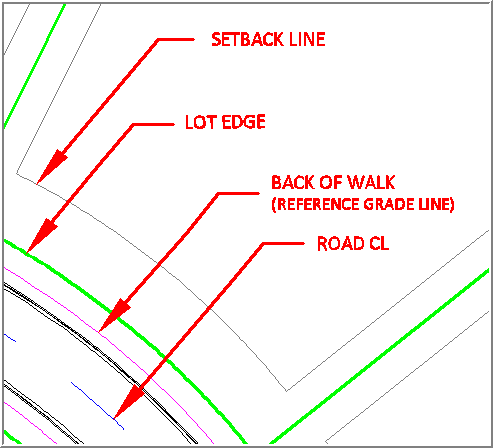 Detail of
roadway and lot edges
Detail of
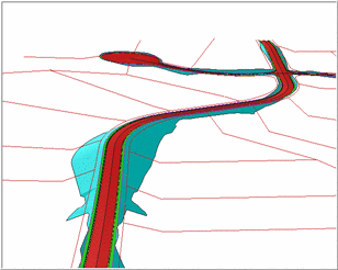
roadway and lot edgesElevating lot edges is useful to establish final grading for
subdivisions or selected lot boundaries, and is also used in the
Road Network routines by
linking to the grade rule file. Once this final grade is
established (by executing Triangulate and Contour selecting the
elevated 3D lot lines as source objects), there are options to
balance cut and fill by adjusting the lot lines' elevations based
on the settings established in the grade rules (.grr) file. The
initial elevation of lot lines will apply the normal slope, and the balancing
routines will only adjust within the limits established by the
minimum and maximum slope settings in the .grr
file.
Consider the following example: you have a small subdivision
with lot lines established using LotNET or other routine, and wish to
elevate them with respect to the edge of the proposed roadway.
Initially, the lot lines are at zero elevation. In this example,
you will use the back edge of the sidewalk that is established as
part of the roadway cross section template that creates all
linework, at proposed grade based on the design profile of the
roadway, and you wish to maintain this edge of walk at its design
elevations.
Small Subdivision
Design with Roads and LotsDetail of
roadway and lot edgesExecute the routine, and you will be prompted for some initial
information:
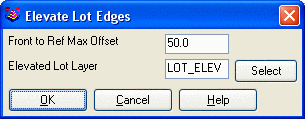
 Front,
side and back lot lines elevated
Front,
side and back lot lines elevatedPulldown Menu Location: 3D Data >> Elevate By Grade
Rules
Keyboard Command: elevate_lots
Prerequisite: 3D reference grade line, lot lines to
elevate