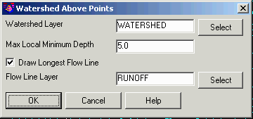
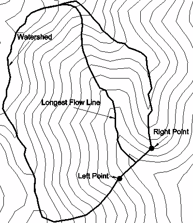
This command creates a closed 3D watershed polyline of the area
that flows through a line connecting two points. The command also
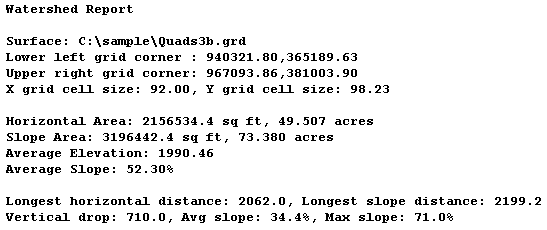
creates a watershed report of the area, slopes and longest flow
line. There is also an option to draw a 3D polyline for the longest
flow line. In the options dialog, the Max Local Minimum Depth is
the most the program will allow the flow to jump over.
This command uses a surface model defined by a grid file. The
Watershed Analysis method is another command to generate watersheds
that uses triangulation surfaces. A triangulation surface model has
the advantage of finding sharp breaks that a grid might skip over
such as for narrow ditches or curbs. For regular surfaces such as a
surface defined by existing contour polylines, the grid surface
model has the advantage of efficiently modeling the surface which
makes it faster. Also when using a grid surface model, it is
sometimes better to decrease the grid resolution (have fewer grid
cells) because this helps avoid local minimums.
Select Surface Model Choose .grd file
Watershed options dialog
Pick bottom LEFT bank of watershed: pick a
point
Pick bottom RIGHT bank of watershed:
pick a point
Pulldown Menu Location: Watershed > Watershed By Grid
Surface
Keyboard Command:
waterabove
Prerequisite: surface .GRD file