USDA Soil Area Download
This command downloads
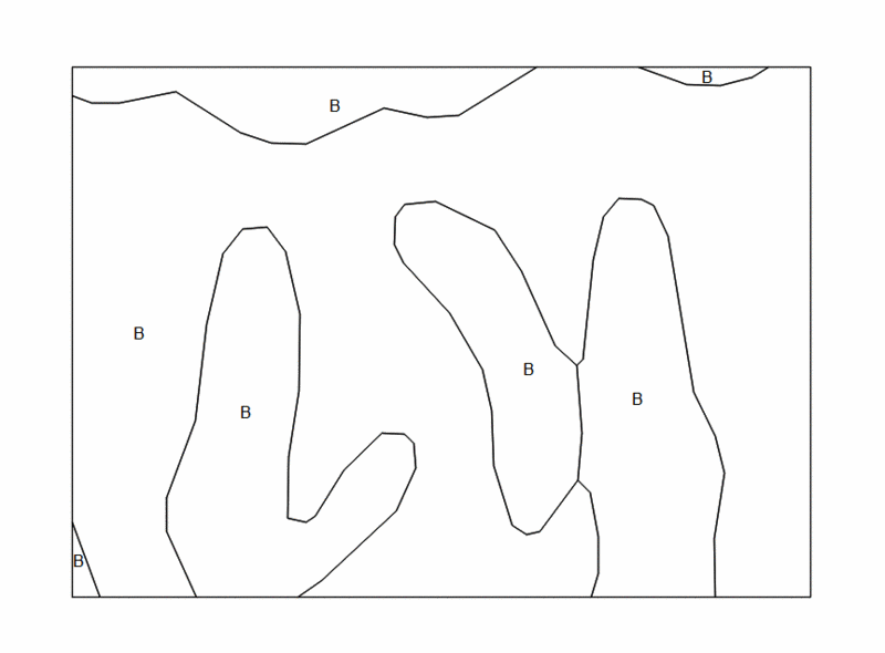
soil group index and soil boundary lines from USDA website for the
area-of-interest, then draws soil polylines and index labels in the
plan view. These soil lines and labels are then used in watershed
analysis to calculate weighted curve numbers when using the SCS
Method.
The program requires
the user to define the dwg grid projection in order to convert the
local area to Latitude/Longitudinal values used on USDA website.
Run command Settings > Drawing Setup to set up the local
projection, zone and Lat/Lon datum.
The USDA classifies soil into four soil types, A, B, C, or D, based
on the soil's ability to infiltrate water during a storm
event. This classification is used in conjunction with ground
cover types, which are broken into the broad categories of Fully
Developed Urban Areas, Developing Urban Areas, Cultivated
Agricultural Lands, Other Agricultural Lands, and Arid and
Semi-Arid Rangelands. These Cover Types are then broken into
as many as three subcategories based on their hydrologic condition,
Good, Fair or Poor. For example, you might draw a polygon
around a wooded area on your surface and determine that this should
be categorized as Other Agricultural Lands, Woods, Good. The
USDA issued data show that the Curve Numbers, depending on the
underlying soil type, would be 30, 55, 70, or 77. Downloading
the Soil Areas might show that the woods has several soil types
within it. If the woods was 25% A, 25% B, 25% C and 25% D, it
would have a weighted Curve Number of 58. The ground cover
type, the hydrologic condition of this cover and the soil type
underneath determine the Curve Number.
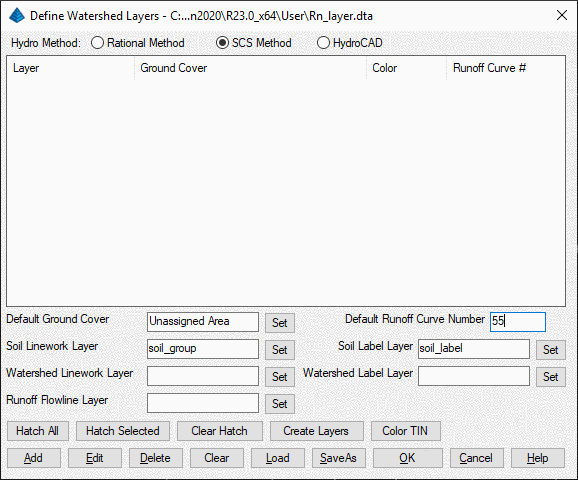
In order to draw soil lines and labels on
the drawing for watershed analysis purposes, it's required to set
up the layers for soil lines and labels. Run command > Watershed
> Define Watershed Layers to set up layers for soil lines and
labels.
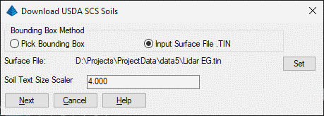
Run Watershed > USDA Soil Area Download, then either pick
bounding box or specify a surface file in order to download soil
lines in side the watershed perimeter.
Pulldown Menu Location: Watershed > USDA Soil Area
Download
Keyboard Command: usgs_soil
Prerequisite: Run Watershed > Define Watershed Layers
command to set soil layers