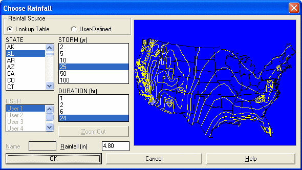
This command allows you to view rainfall maps while entering the rainfall amount to be used by other hydrology commands. First choose a storm and duration from the list. Then choose your location from the state list or pick your location on the map. You can enter the rainfall amount in the box in the lower left or pick your location on the map.
Reference maps based on TP-40 and TP-47 are provided for all
fifty states for the different storm intervals. You can also setup
user-defined lookup tables for up to five areas. For each area, you
can specify a name and rainfall amounts for each storm interval.
The first time the you select a user-defined storm interval, the
rainfall amount will be blank. Enter in the rainfall amount and the
next time that interval is selected, your entered value will be
there. All rainfall amounts are in inches. The user-defined
values are stored in a file called rainmap.ini in the Carlson USER
directory.
TP-40 and TP-47 are older rain tables. The NOAA Atlas 14 is a
more recent rain table.
Pulldown Menu Location: Watershed
Keyboard Command: rainmap
Prerequisite: None