This command will create contours of various strata attributes,
either directly from the drillhole data or from existing grid
files. When the command is executed, the below dialog will
appear.
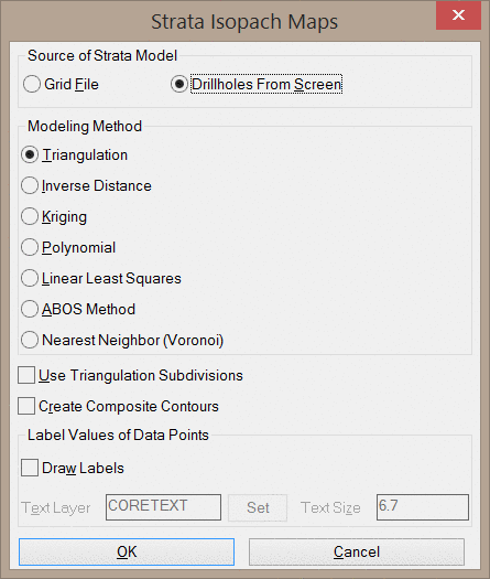
Source of Strata Model: This option determines the source
of the contour information.
The Grid File option will use an existing grid file to create the contours. When this option is used, the command is no different than the Contour from Grid File command.
The Drillhole from Screen option will use the drillholes in the drawing to create a temporary grid file and contour from that grid. When this option is used, the prompts will be similar to that of the Make Strata Grid Files command, followed by the Contour from Grid File command.
See the above links for explanations of each routine.
Pulldown Menu Location:
StrataCalc
Keyboard Command: chiso
Prerequisite: Drillholes