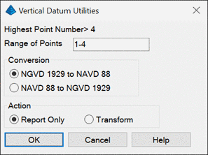
This command calculates the elevation difference between NGVD
1929 and NAVD 88 for points from the current coordinate file.
Before running this command, the grid projection for the drawing
must be defined in Settings > Drawing Setup so that the points
can be geolocated. The Report Only option uses the Report Formatter
to report the elevation differences. The Transform option updates
the point elevations in the coordinate file.
Pulldown Menu Location: Points > Point Utilities
Keyboard Command: vdatum_util
Prerequisite: Coordinate file