This command allows you to open drawings either by browsing
folders or using georeferenced data from within the project
drawings.
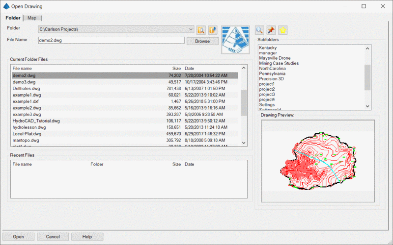
The Folder tab lets you find existing drawings by searching
through folders and recent folder locations as in previous
versions.
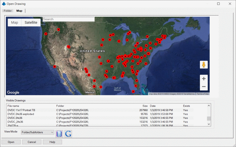
The Map tab displays a Map/Satellite interface that lets you
pan, zoom, and browse georeferenced project drawings. In the
Visible Drawings location are listed georeferenced drawing files
that would appear in the current map and also follow the criteria
as selected by the current View Mode listed at the bottom of the
dialog box.
View Modes:
Folder: Displays georeferenced drawings in the current
folder on the folder tab that also appear in the current map
view.
Folder/Subfolders: Displays georeferenced drawings from
the current folder (and all of its sub folders) on the folder tab
that also appear in the current map view.
Drawing Database: Displays all the georeferenced drawings
that would be visible in the current map display. Only
georeferenced files may be added to the drawing database. If you
pan or zoom the map so no georeferenced files would be visible, the
last visible drawings will still display in the visible drawings
list until a new drawing is found.
Recent Drawings: Displays recently opened georeferenced
files that would be visible in the current map display.
Use Filter Criteria: Displays all drawings from the
drawing database using the current filter critera.
Drawing Database: Opens the Drawing Database dialog
box.
Output to Google Earth: Writes database drawings out to
Google Earth Pro (if installed on PC) as temporary places.
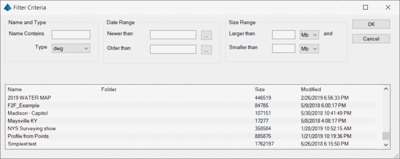
Drawings that have been added to the Drawing Database may be
filtered down using the following criteria in addition to the
current map view: Name and Type; Date (Modified) Range; and Size
Range.
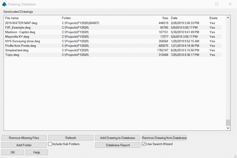
Remove Missing Files: Removes files from the database
that no longer exist in the location from whence they were added.
If you want to remove a large amount of files at once, you can
temporarily change the folder name of the root folder of many job
files, and then run this command to remove the files, then rename
the folder name change back to the original name.
Refresh: Re-reads the database and displays the current
list of drawings.
Add Drawing to Database: Prompts you to browse and locate
a new georeferenced file to add to the database.
Remove Drawing from Database: Removes the highlighted
drawing from the database.
Add Folder: Prompts for a folder to be selected. Any
georeferenced drawings contained in that folder (and any included
subfolders if this item is checked) are then added to the database.
Duplicate named files from different locations or folders may
reside together in the database.
Database Report:/b> Reports on all files contained in the
database. You can report items such as Full Name (Path and Drawing
name); Date Modified; Size; Lat/Lon and if the file still exists in
the original location.
Use Search Wizard: Displays a wizard that will attempt to
add georeferenced drawings from the current folder/subfolders to
the database when the current folder is set to a new
folder.
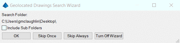
When you select a different folder from the folder tab to search
or open drawings, then by switching back to the Map tab the
Geolated Drawings Search Wizard displays if this is toggled ON in
the Drawing Database. By using this search wizard, drawings will be
automatically added to the database from the selected folder (and
sub folders).
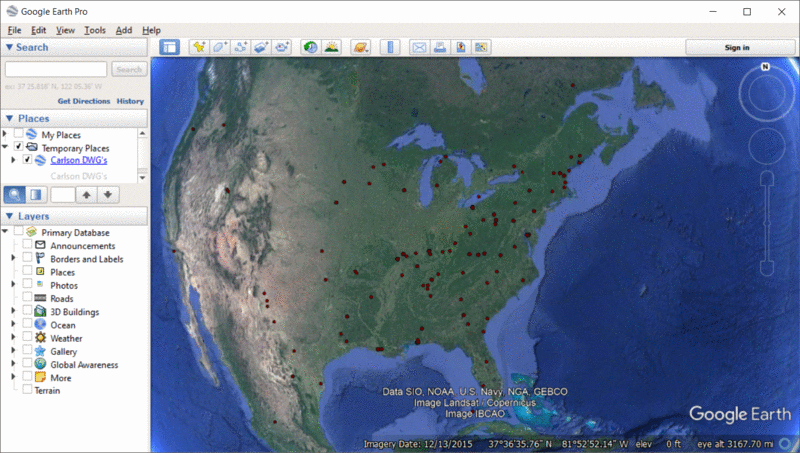
Output to Google Earth writes all the database drawings out to
Google Earth Pro (if installed on PC) as temporary places. These
places may be added to 'My Places', be used to get directions or to
display drawing information from within Google Earth.