 '
'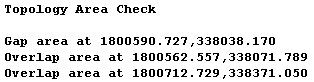
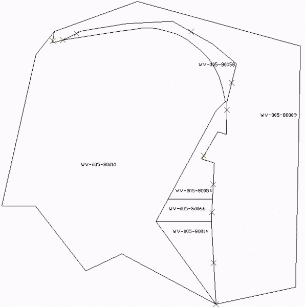
This command checks an area coverage made of closed polylines to
find any gaps or overlaps. For example, the closed polylines could
be for property boundaries. The coordinates at the gaps and
overlaps are reported. There is also an option to draw symbols at
the gaps and overlaps to highlight these problem areas in the
drawing.
'Topology Area Check dialog
Select closed polylines to process.
Select objects: pick the polylines
Pulldown Menu Location: GIS Tools
Keyboard Command:
area_check
Prerequisite: closed polylines