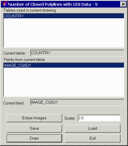
This command draws images inside the selected closed polylines with attached GIS image files. Images can be assigned to polylines by the Input-Edit GIS Data command.
The program starts by selecting closed polylines in the drawing
with GIS data. Then a dialog appears for specifying the image to
draw. This dialog displays a list of all the GIS table names found
in the selected polylines. First choose a table to process. Then
the image fields defined for this table are displayed in the lower
list. Only one image can be draw inside the polyline. The Erase
Images button will erase any existing images inside the selected
polylines. The settings can be saved to and recalled from a GIS
settings file (.gsf) using the Save and Load buttons. Once all the
settings are ready, pick the Draw button to draw the images. The
images are drawn in the centroid of the polylines.
|
|
|
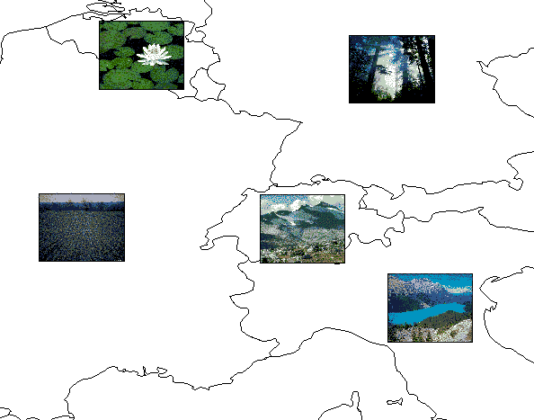
Example of images drawn inside closed polylines |
Pulldown Menu Location: GIS Data >Label GIS Data
Keyboard Command: display_polygon_image
Prerequisite: Closed polylines with linked GIS
images