There are primarily three types of GML files:
Points, LineStrings and Polygons. Each will provide different
options on Import. Once the GML file is selected, Carlson
detects the data contents of the file and sets the dialog options
for importing either polygons, linestring or points. Carlson
GIS also supports the use of three other types of GML files:
MultiPoint, MultiLineString and MultiPolygon. LineStrings are
brought into Carlson as open polylines and Polygons are as closed
polylines in the drawing.
If single file has been selected, then it would display Import from GML dialog. This dialog will list all available features in the GML File. The user can select import all features or one of the features in the list. Then select corresponding fields for the Point ID/Entity ID, Description, Elevation and Layer, etc. The program uses the GML feature name as the table name in the database. The selected fields would be used to fill Carlson internal fields. If no field is selected for Point ID/Entity ID, then the program will create an unique ID for each entity. If no field is selected for Description, then the description will leave blank. If no field is selected for Layer, then the table name will be used as layer name. If the feature type is Point/MultiPoint, then it will allow user to select a name for the CRDB. The program then will also output points geometry and GIS Data to CRDB.
If single file has been selected, then it would display Import from GML dialog. This dialog will list all available features in the GML File. The user can select import all features or one of the features in the list. Then select corresponding fields for the Point ID/Entity ID, Description, Elevation and Layer, etc. The program uses the GML feature name as the table name in the database. The selected fields would be used to fill Carlson internal fields. If no field is selected for Point ID/Entity ID, then the program will create an unique ID for each entity. If no field is selected for Description, then the description will leave blank. If no field is selected for Layer, then the table name will be used as layer name. If the feature type is Point/MultiPoint, then it will allow user to select a name for the CRDB. The program then will also output points geometry and GIS Data to CRDB.
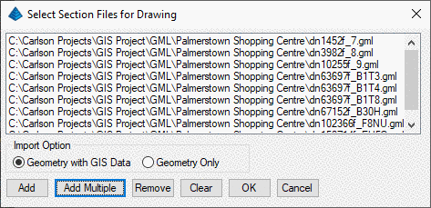
If multiple files have been selected, then it
will not prompt for importing setting. It will automatically
create an unique ID for each entity and use the feature name as the
default layer name.