In addition to exchanging data with Esri using SHP files,
Carlson GIS supports Feature Data within a drawing that is
compatible with Esri ArcGIS software. This data is stored in a
format created by Esri known as Mapping Specifications for CAD, or
MSC. Starting with ArcGIS 9.3.1, Esri creates a DWG with MSC data
using the Export To CAD function in the ArcGIS Toolbox. You can
select which features to export to the DWG. The DWG with MSC
contains the geometry of the features, the feature attribute
definitions and the attribute values. Essentially, the DWG with MSC
is a complete geodatabase. In Carlson GIS, set the data format to
Esri under GIS Settings and the GIS commands such as Input-Edit GIS
Data will work with the Esri data. You can both add and edit GIS
data in Esri format in the DWG. Then to bring the data into ArcGIS,
choose the Add Data function in ArcGIS and pick the DWG file. With
the MSC data format within the DWG, ArcGIS will recognize the
features in the DWG instead of everything defaulting to generic
CAD.
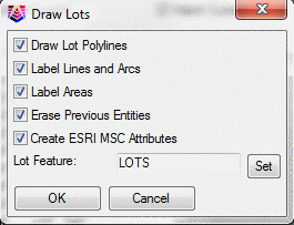
Several Carlson programs can create this data, such as LotNet, SewerNet, Mining Timing and Surface Mine Reserves. When lots, pipe networks or mining areas are drawn, there are new options to create Esri MSC in the process. When selected, the drawing can then be saved and loaded into ArcGIS as data, and the Features and Attributes created are available to ArcGIS. Here is where MSC is created from the Draw Lots command in Lot Manager.
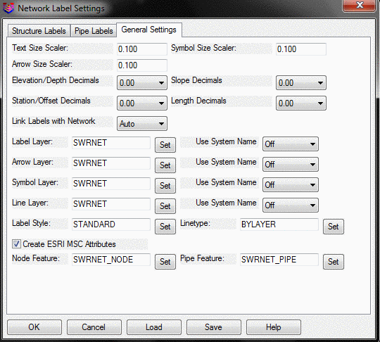
Here is where it is specified to create MSC when plan view of a
Sewer Network is drawn.