The ESRI_ArcGIS_Services
command provides access to existing ESRI image files.
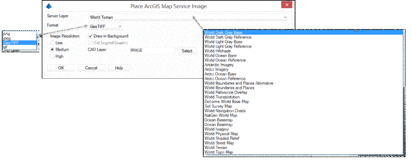
Server Layer:
Contains a list of available image files from
the ESRI library
Format Type: Select the image format
type from:
Pick first corner of bounding box: Indicate one corner of a rectangular box that identifies your area of interest.
Pick second corner of bounding box:
Indicate the other corner of a rectangular
box that identifies your area of interest.
Pulldown Menu Location(s): GIS Data
Keyboard Command: eagmsExport
Prerequisite: Internet connection, Coordinate System
Projection set through Drawing
Setup