This function inserts a geo-referenced image files into the
drawing. The geo-reference data supplies the position for the image
so that the image can be placed without prompting for the position,
rotation or scale. This eliminates the guesswork in inserting,
moving, and rotating raster images to the project area. This
process requires the presence of an accompanying World file. The
supported World File formats include: .TFW, .JGW, .J2W, .PGW, .SDW,
.JP2, .J2K, .JPF, .JPX, .JPM and .ECW.
The World Files are a separate file from the image file. For
example, a .JGW is the World File for a .JPG image file. The world
file and the image file need to be in the same folder.
In addition to working with World File, this command also
supports geo-referenced .TIF file that have the world data embedded
in the image file.
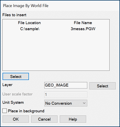
You begin by selecting the World file to process by picking the
Select button. You can import multiple images. The Layer sets the
layer name for the image entity in the drawing. The Unit System
allows for scaling the image such as having an image in metric
units and a drawing in feet units. Besides meters-to-feet
conversions, you can also apply a custom scale factor. The Place In
Background sets the display order of the image to the back.
Pulldown Menu Location: GIS Tools
Keyboard Command: geotiff
Prerequisite: A georeferenced image file