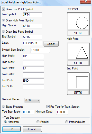
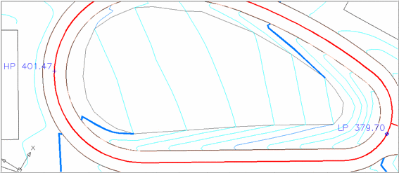
This command finds and labels the high, low and end points of
selected 3D Polylines. This is useful for drainage studies, finding
low spots for placement of culverts or inlets, checking overhead
clearances, etc. The Erase
Previous option will erase labels created by this routine
when running again on the same polyline. The Flip Text for Twist Screen option
applies to text labels that would be upside-down in the current
view depending on the polyline orientation. When a polyline has
elevations that go up and down, multiple high and low points can be
labeled for the different local highs and lows. The Minimum Depth setting controls how much
elevation difference is needed to label a local high or low
point.
 Pulldown Menu Location: 3D Data
>> Label Polylines
Pulldown Menu Location: 3D Data
>> Label Polylines