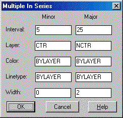
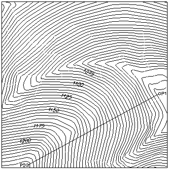
This command can be used to quickly and accurately assign the elevation of series of polylines that have been converted from raster or digitized without correct elevations. The routine will automatically assign elevations to the polylines crossing the fence line selected by two points. At the same time the elevations are changed, the program can assign it a new layer, color, linetype, and polyline width. This process usually works best if contours are in a temporary (white) layer to start. When they are processed, they will take on the color of the new layers making it easy to distinguish which polylines have been processed.
Pulldown Menu Location: 3D Data > Assign Contour
Elevations
Keyboard Command: grpcelev
Prerequisite: Digitized polylines