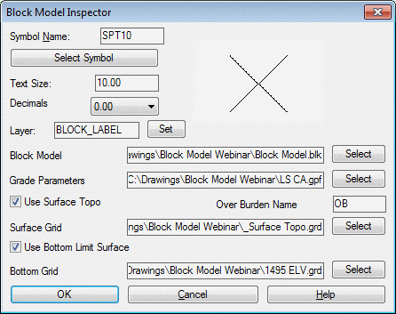
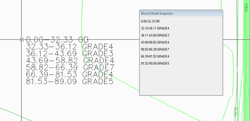
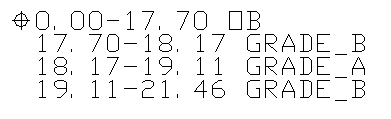
This command displays the from and to depths, and
the grade value as the cursor is moved across the block modeled
area. The location can be labeled with a left mouse click to put
the text in the drawing. This is a quick way to check the model and
for labeling maps to give to the field crew showing the depth range
and grade. If "Use Surface Topo" option is on, the depth is
calculated from the "Surface Grid" and labeled as "Over Burden
Name", such as OB. The Use Bottom Limit Surface will contain the
model so that it only labels down to it, such as a flat bench
elevation, or pit floor grid. If there exists a no-grade zone for
certain elevation range this zone is reported as No-Grade
zone.
Reading cell> 4828
Select symbols/<Enter or pick point>:
Pulldown Menu Location: Block Model
Keyboard Command:
blkm_inspector
Prerequisite: Need a BLK model file and a GPF grade
parameter file.