This command displays placemarks in Google Earth for DWG files.
The command starts by prompting for a folder. Then all the DWG
files in this folder and the sub-folders are used to make the map
for Google Earth. In order to use a DWG file, the coordinate system
must be set in the DWG using the Drawing Setup command. The command
creates a Google Earth file called kmldwgs.kmz in the
%appdata%\Carlson Software\version\platform\USER folder.
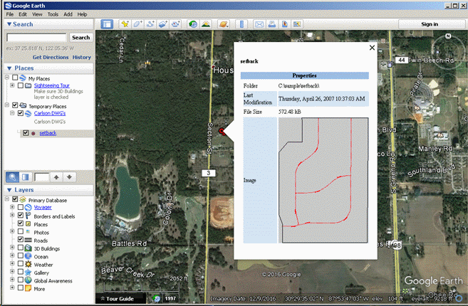
In Google Earth, the location of each DWG file is shown with a
circle marker. When you on a marker, the DWG properties are shown
including the folder location, date, file size and graphic
preview.
To load a DWG file from Google Earth, go to Tools > Options
in Google Earth. In the Options dialog, go to the General tab and
turn on Allow Access To Local Files and Personal Data. Then when
you pick on a placemark to open it up, you can double-click on the
properties window to load that DWG file into CAD.
Pulldown Menu Location(s): File > Drawing
Utilities
Keyboard Command: dwg2kml
Prerequisite: DWG files with defined coordinate
systems