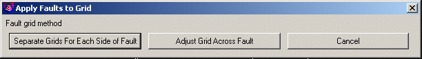
This command is used to offset the grid values of an existing
strata elevation grid file to adjust for faults. The program saves
a new grid file with the values offset based on the fault lines
drawn with the Draw Fault Line command. There are two methods. The
Separate Grids For Each Side of Fault method applies for thrust or
reverse faults where the strata are folded over top of themselves
within the fault zone. In this case, the strata can be modeled
separately for each side of the fault. The Adjust Grid Across Fault
applies when the strata can be modeled with the same grid for the
whole site. This method adjusts the grid in the fault zone.
Before running Apply Faults to Grid for this method, setup the
faults and strata grids as follows:
1. Draw a fault polyline with the dip angle and elevation
difference set using the Draw Fault Line command.
2. Draw a closed polyline around the area on the high side of the
fault.
3. Create strata grids like usual. Make separate strata grids for
the high and low sides.
4. Create a surface topo grd as usual.
Then run Apply Faults To Grid. The program prompts for the fault
polyline and high side polyline from steps 1,2 and the grids from
steps 3,4. The processing for the high side strata grids is
slightly different than the low side because the way the program
goes about embedding the fault surface to the strata surfaces. For
the high side, you specify one strata grid at a time. For the low
side, you specify the top and bottom strata grids (ie A1_TOP.grd
and A1_KEY.grd).
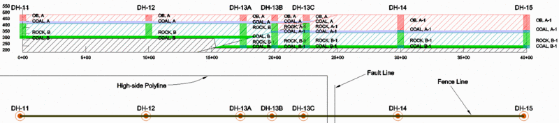
The Fault Influence Distance is the offset distance away from
the faultlines that will be used to transition from the original
grid to the faulted values.
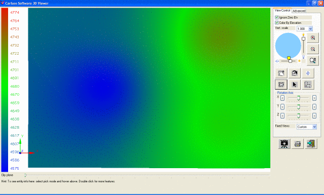 This is the grid before applying the
faults
This is the grid before applying the
faults
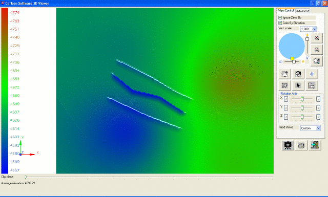 This is the grid after applying the faults