Haul Road Manager
This command builds and links the haul road network, recognizing 3D
polylines and adding them to the network. All possible roads must
be drawn as 3D polylines in CAD, either draped onto the surface
model, or snapped to contours. Individual layers can be used for
clarity to see the roads in the manager by color and layer. There
aren't any tagged segments to select the first time this command is
run, so the preview image will be blank. The segments must be added
by picking the green "+" button to bring them into the editor.
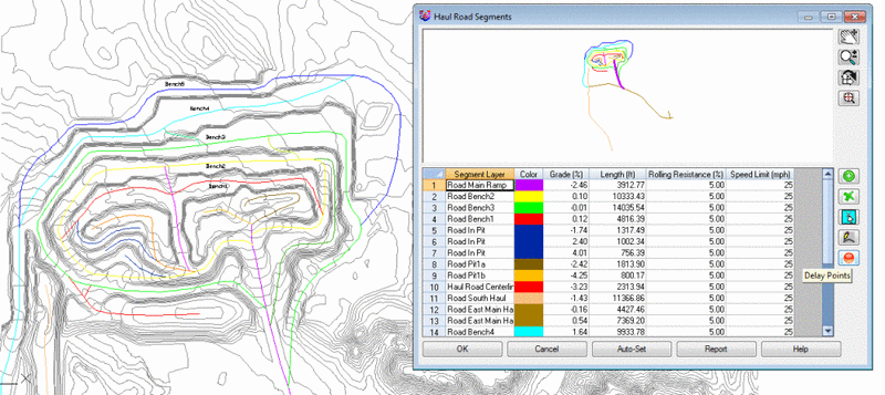
- Preview Window Display:
The upper preview window has four buttons for Pan, Zoom Realtime,
Rotate and Zoom Extents.
- Add Segments: Selecting the green "+" button will prompt
for selecting the 3D polylines in CAD to add to the haul road
network. This must be done initially if there are no segments
found.
- Remove Segment: This green "X" button will remove the
highlighted segment from the manager.
- Pick Segments: The
Select from Screen, Pick Segments button is used to pick already
named haul road segments, and add them to the manager. They must be
already tagged with the Add Segments for them to be
recognized.
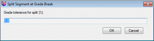
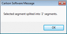
- Split at Grade Break:
Selecting this button will split the haul roads into smaller
segments, based on the percent grade tolerance so that each segment
is within that slope tolerance. This isn't a requirement, but the
idea is to have segments with constant grade as the truck speed is
depended on the grade of the road, and this will divide the road
into smaller segments if desired. This will also break the 3D
polylines into the smaller segments, so it is recommended to Save
the drawing as a new name before breaking, so that there is a back
up to go back to if necessary. There are two dialogs that appear
from this command. It will only break the highlighted segments, so
it is easy to control which roads are being divided.
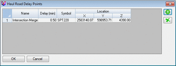
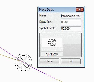
- Delay Points: These are
point symbols inserted into the drawing the will trigger a delay
event for the specified number of minutes. Examples would be a stop
sign at an intersection, or a one lane bridge where trucks have to
stop. Any symbol from all of the libraries can be inserted to
represent the location. These delays will be accounted for when the
trucks pass over that spot.
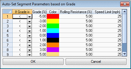
- AutoSet: The AutoSet
Segment Parameters based on Grade option colors all the haul roads
based on their
perfile:///C:/Carlson%20Manual/manuals/Carlson2007/Surface_Mining/Reserves_Timing/Haul_Fleet_Manager/Haul_Truck_Manager.htmlcent
slope. This is an option to graphically see the slope of each road,
simply by the color it is drawn in. This will also change the color
of the 3D polylines in the plan view. They will stay on their
original layers, so they can be set back to color ByLayer if
desired. The slope interval was set here to a 1 or 2%, starting at
-5%, as an example.
 Notice in the image below, that the new
colors are set by the percent slope of the road. These colors are
now different than the initial image where they were colored by the
layer.
Notice in the image below, that the new
colors are set by the percent slope of the road. These colors are
now different than the initial image where they were colored by the
layer. 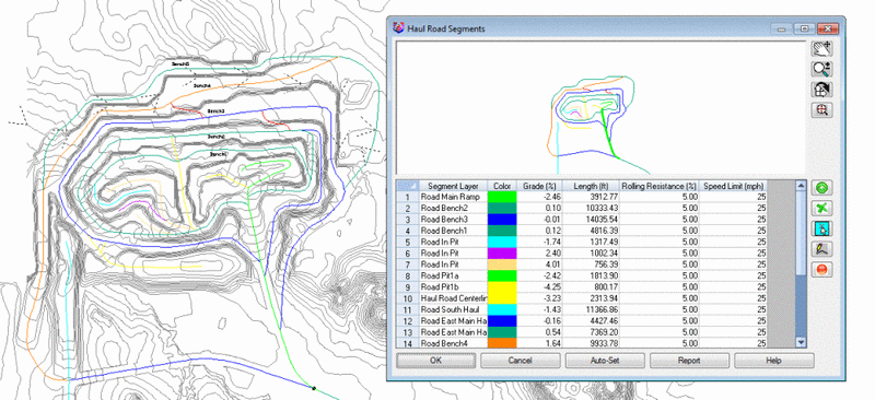
Now that the haul roads are defined
in the manager, they can be used in the haul road processing
commands.
Pull-Down Menu Location: Reserves/Timing in Surface
Mining
Keyboard Command: haul_roads