Select Surface Model dialog box
Choose the grid file or triangulation file that models the surface. If a grid is selected, it will prompt:
Extrapolate grid to full grid size (Yes/<No>)? Yes If the limits of the surface data doesn't cover the entire grid area, then the values for the grid cells beyond the data limit must be extrapolated in order to compute slopes in that area. This prompt only appears if there are grid cells without values.
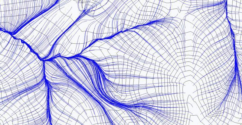
Local pond spillover depth <4.80>: press Enter This allows the runoff line to continue past flat or low points in the grid or TIN, by allowing these area to fill up with water, in essence, up to the specified depth, thus letting the runoff polyline continue on.
Draw tracking for all grid cells or pick individuals [All/<Pick>]: press Enter Pressing Enter leads to individual picking of runoff tracking lines, while A for All would fill draw runoff polylines starting from each grid cell or each triangulation triangle.
Pick origin of rain drop: pick a point at the top of the run off polyline
Pick origin of rain drop (Enter to end): press Enter
Pulldown Menu Location: Watershed
Keyboard Command: runoff
Prerequisite: A .grd file created by Make 3D Grid File or a .flt (TIN) file created by Triangulate & Contour.