 Surface inspector shows you
real-time elevations as you move the cursor over your
surface.
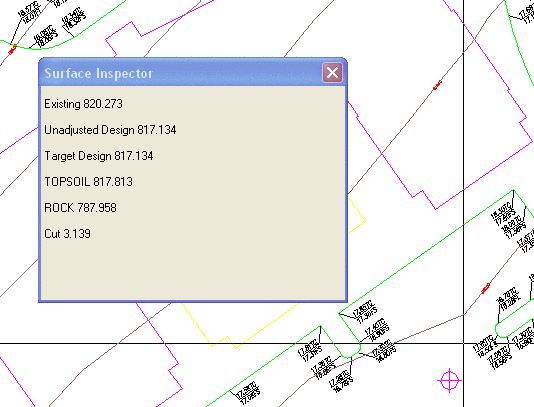
Surface inspector shows you
real-time elevations as you move the cursor over your
surface.This command allows you to report and optionally label
elevations from your drawing. You can analyze all of your different
surface files at one time. After running the command, Surface
Inspector will begin showing you real-time elevations for each
surface as you move the cursor on the screen. If you pick a point
or enter coordinates, the elevation will be labeled along with the
surface name. Surface inspector shows you
real-time elevations as you move the cursor over your
surface.
Prerequisite: Surface Model (s)
Keyboard Command: surfvals