This command is a customized and simplified method for
calculating volumes in a situation in which the entire volume to be
calculated is below the perimeter elevation, such as in the case of
a pond or pit. The complimentary command, Calculate
Stockpile Volume, is for the opposite situation, in which the
entire volume to be calculated is above the elevation of the
perimeter.
The program internally computes base and final grid surfaces
from drawing geometry. The base surface is calculated from a
3D polyline representing the perimeter of the area being
analyzed. If that 3D polyline is drawn on the PERIMETER
layer, the command will automatically detect and use it. If
no 3D polyline is found on that layer, you have an opportunity to
manually select another 3D polyline to use. The 3D polyline
perimeter can be drawn with the Draw 3D Polyline Perimeter command
before using this routine.
The 3D polyline perimeter is also used as the inclusion perimeter for the volume calculation.
Additional 3D polylines can also be specified to more precisely
define the base surface. These must be on the BASE_BREAKLINE
layer to be used for this purpose. These can be generated by
the Draw 3DPoly Base Breakline routine.
The final surface is calculated from all of the other selected
drawing entities such as points, line, inserts, and polylines,
along with the perimeter polyline, but not including the
BASE_BREAKLINE polylines.
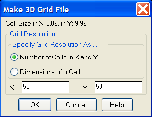
You have the option of setting the resolution of the grids.
Ignore Zero Elevations [<Yes>/No]?
Select Pond/Pit entities and perimeter.
Select objects: pick the objects that define the surface and
the 3D polyline perimeter
Select Pond/Pit perimeter polyline:
Make Grid File dialog Set the resolution and then click OK.
Keyboard Command: pitvol
Prerequisite: Data representing the pond/pit surface and a
3D polyline representing the perimeter of the
pond/pit.