Strata Polylines
Strata Polylines define strata elevation or thickness along
linework instead of a single point like Place Drillhole. Linework
defined as Strata Polylines are incorporated with Drillhole Data to
create surface models. Note: Strata surface models can not be made
exclusively from Strata polylines, some drillholes need to be
placed as well.
Tag Strata Polylines
This command allows the user to select polylines that define a
Strata. Pick the Strata from the list or type in the name in the
Enter Name field. Any Strata you enter in must match a strata
defined in Drillhole/Strata Settings in order for the surface to be
created.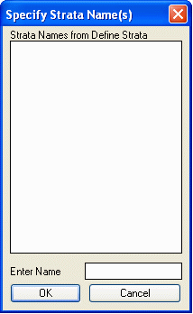 After selecting a Strata and
pressing enter you will be prompted for the type of polyline.
After selecting a Strata and
pressing enter you will be prompted for the type of polyline.
Type of strata polyline [<Elevation>/Thickness]?
Elevation signifies that the Z value for the polyline(s) you are
about to select represent the bottom elevation of the previously
selected strata. Thickness means that the Z value represents
thickness of the strata. Choose one of these options and select the
polylines.
Prerequisite: Drillhole/Strata Settings, desired polylines
Keyboard Command: stratatag
Highlight Strata Polylines
This command allows users to identify Strata Polylines by either
picking on a polyline(s) or by searching the entire drawing. The
command will then dash the polyline in the plan view.
Prerequisite: Tag Strata Polylines
Keyboard Command: highlight_strata_pl
Identify Strata Polylines
This command allows users to identify topsoil polylines by picking
on a polyline. The command will then report the Strata name and
Type (either Elevation or Thickness).
Prerequisite: Tag Strata Polylines
Keyboard Command: strataid
Untag Strata Polylines
This command allows the user to remove previously tagged Strata
Polylines so that they are not included in the strata model.
Prerequisite: Tag Strata Polylines
Keyboard Command: stratauntag