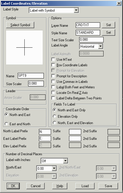
This command will label a coordinate on the screen. You can
choose to label the northing and easting, or the elevation, or all
three properties. The point can be picked on screen, or specified
by point number from the current coordinate (.CRD) file. Options
include drawing a box around the label, labeling both feet and
meters, setting the layer name for the label, setting the display
precision, deciding whether or not to use a leader and selecting a
change in the symbol used to mark the point. You can also set the
text prefix and suffix for the label. Additionally, you can locate a label on Real Z
Axis. The Label With Inches option labels with whole feet
and inches for the decimal part. The Prompt for
Description option is for including a description with the
label. The Use MText option chooses between creating the
labels as MText or regular text entities. The Label
Angle setting chooses between having the labels horizontal, at
a fixed azimuth or prompting to pick the angle for each label. The
Label Style chooses between labeling with a leader, with a
symbol, as an MLeader entity or along the x/y axis.
 Label
Along Axis
Label
Along Axis
 There is also an option to label the Delta X, Y and/or Z between
two points, which is called Label Delta Between Two Points.
When this option is clicked On, and after the prompt, you will
first click two points locations. The label, with the delta
value(s), will then be placed precisely in between these two pick
locations. If, for example, the North, East and Elevation button is
chosen, the resulting label will show the N, E and Z delta
values.
There is also an option to label the Delta X, Y and/or Z between
two points, which is called Label Delta Between Two Points.
When this option is clicked On, and after the prompt, you will
first click two points locations. The label, with the delta
value(s), will then be placed precisely in between these two pick
locations. If, for example, the North, East and Elevation button is
chosen, the resulting label will show the N, E and Z delta
values.
Label Coordinates/Elevation
dialog
Point to Label ?
Pick point or point number: pick a point
Point to Label (ENTER to End)?
Pick point or point number: press Enter
Pulldown Menu Location: Annotate
Keyboard Command: labcoor
Prerequisite: None