This command creates closed polylines that represent pit inclusion areas for Surface Mine Reserves or the Surface Timing routines. The pit polylines are created by advancing a baseline polyline along a minable boundary. The sides and end of the pit polylines are defined by the minable boundary polyline. This polyline should be open at the end of the baseline polyline. Be sure to create the baseline polyline longer than the minable boundary so that the program can find the intersection of the advancing baseline with the minable boundary. The next pits will be named by incrementing the pit name by one. The baseline polyline is advanced a distance such that the pit volume equals the target volume.
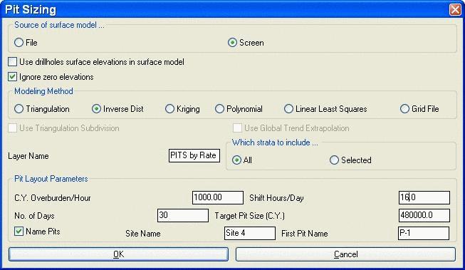
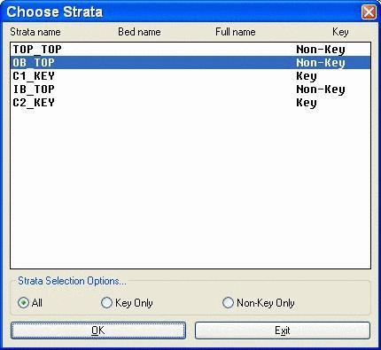
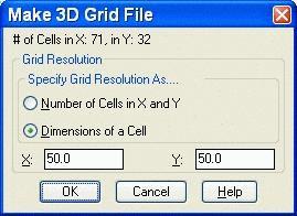
The surface model is either represented by contours on screen or a grid file. If neither is available, there is an option to Use drillhole surface elevations in surface model. The Ignore zero elevations will ignore anything on screen with no elevation. When modeling from the drillholes, there are 5 modeling methods available, which are defined elsewhere in detail. If a roof and floor grid exist of the strata to target, then use the Grid File option and these two grids will be prompted for. If Triangulation is the selected modeling method, then the options to Use Triangulation Subdivision (defined in Triangulate and Contour) and Use Global Trend Extrapolation (explained in Make Strata Grids) are active. There is the box to create a new layer name for the new pits. If coming from drillholes, there is the option to choose which strata to include. If Selected is checked, then the following Choose Strata box appears. Holding the CTRL or Shift buttons down allow for multiple strata selection. The grid cell size and resolution are set in the Make 3D Grid window, also only if coming from drillholes.
Pit
Layout Parameters
The cubic yards or meters / hour is set here with the shift hours
per day and number of days worked per period. This will calculate
the Target Pit Size. In this example, 480,000 CY of OB_TOP strata
is the targeted pit size. Turning on the Name Pits box activates
the Site and First Pit Name windows. The subsequent pit names will
be incremented by one from the starting pit name.

|
| Starting linework |
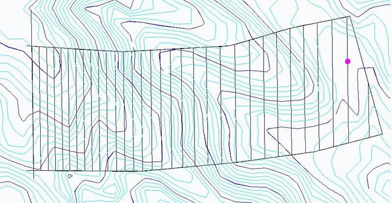
|
| Final pit layout. Notice that the pits get wider to the east as the OB_TOP thins and the pits must be wider to mine 480,000 CY. |
Pit Sizing dialog
Select surface entities & at least 3 drillholes
Select objects: select the drillhole symbols and the contour
polylines
Select mine boundary polyline: pick the minable
boundary
Make Grid dialog Choose a grid resolution.
Use inverse distance to which power
(First/<Second>/Third/Other)? press Enter
Select baseline polyline: pick the baseline
polyline
Select minable boundary polyline: pick the minable
boundary again
Pulldown Menu Location: Boundary in the Advanced Mine
Module
Keyboard Command: pitsz