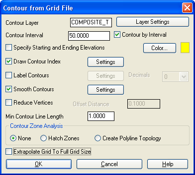
Contour from Grid File
This command creates contours from a surface model defined by a
grid file. Contouring from a grid employs a different method than
from a triangulation network and generally produces contours that
loop more. The grid has data points at a regular interval while the
triangulation has edges for every point and breakline in the
surface. The smoothness of the contours depends a great deal upon
the grid resolution.
Hatch Zones will fill the
intervening spaces between specified elevation ranges with hatch
patterns or solid color fills.
Create Polyline Topology
will create closed polylines for each contour range and will draw a
zone text label within each area. This polyline topology can be
used in GIS routines such as Polygon Processor.
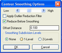
Smooth Contours Setup: The
Low to High slider bar controls the amount of smoothing. This
smoothing method is based on the Bezier method. The Apply Outlier Reduction Filter option
will remove spikes in the contour polylines that don't follow the
general trend of the contour. The Reduce Before Smoothing option applies
the Reduce Vertices function on the contour polylines before
applying the Bezier smoothing. By reducing before smoothing, the
contours will have more freedom to smooth since the Bezier method
holds all original polyline vertices and the reduce will result in
fewer vertices to hold. The Offset
Distance is the maximum distance the contour is allowed to
shift when removing vertices during reduce. Smoothing Sub-Division will internally
subdivide the grid cells with a quadratic smoothing algorithm to
help create smoother contours.
Prompts
Select the Inclusion perimeter polylines or ENTER for
none.
Select objects: pick a closed polyline for the contour
boundary if any
Select the Exclusion perimeter polylines or ENTER for none.
Select objects: pick a closed polyline for the area to
exclude
Grid File to Process dialog select a .grd file
Contour from Grid File options dialog
Extrapolate grid to full grid size (Yes/<No>)? press
Enter This prompt appears if your grid extends beyond the
limits of your data points in some areas.
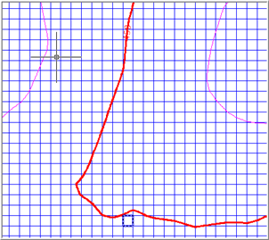 Contours
interpolated from GRID
Contours
interpolated from GRID
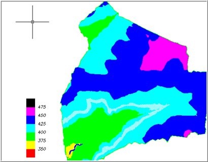
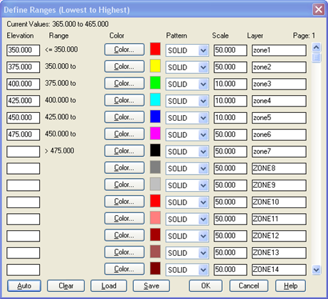 Setting color
ranges using "Hatch Zones" option
Setting color
ranges using "Hatch Zones" option
Keyboard Command: cntrgrd
Prerequisite: A grid file