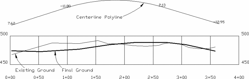
This command labels the elevation difference between two profiles at specified stations. The text label is drawn along the polyline centerline in plan view. Cut is labeled as negative and fill as positive.
Existing Ground Profile dialog Specify a profile file to
read.
Final Surface Profile dialog Specify an existing profile
file to read.
Select centerline polyline: Pick a polyline. This represents
the centerline and should be drawn in the direction of increasing
stations.
Starting station of polyline <0.0>: press
Enter
Label all polyline vertices (<Yes>/No)? press
Enter This option will label the elevation difference at the
stations of each point on the polyline centerline.
Pick points to label (Yes/<No>)? press
Enter This option allows you to pick points along the
centerline to label.
Prompt for text position (Yes/<No>)? press
Enter This option allows you to pick the position of each
elevation difference label. Otherwise the text is automatically
centered at the point on the polyline.
Text size <4.00>: press Enter
Pulldown Menu Location: Profiles > Profile
Utilities
Keyboard Command: prodiff
Prerequisite: Two profile files