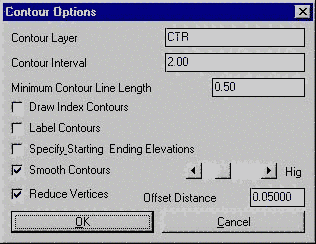
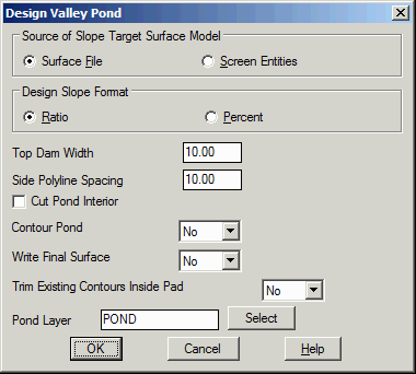
Design Valley Pond
This feature will design a valley pond, essentially by creating
a dam across a low area, beginning with a surface model file (.GRD,
.TIN, .FLT), or screen entities representing the surface, and a 2D
polyline that defines the top of dam. These components must be
present before starting. If Screen Entities are used, the
program internally creates a grid mesh from the surface entities
(Contours, Tri-Mesh, 3D polys) found by doing a crossing selection
of the grid limit.
The design is drawn as 3D polylines with an option to drawn
contours on the pond, and the earthwork volumes and stage-storage
volumes are calculated.
The Cut Pond Interior option has two
methods for cutting volume from the pond interior. This cut will
create more water storage. The trace method prompts you to define a
3D polyline by picking points starting at the dam and going around
the pond counterclockwise. At each point you enter an elevation.
The default is the current ground elevation and typically you would
enter a lower elevation. Then you enter a cut slope and the program
will cut from this perimeter polyline at the entered slope. The
polyline method requires a pre-drawn closed polyline inside the
pond. The program will ask for a depth to cut and a cut slope.
Polyline is set to the current ground elevation minus the cut
depth. Then the program cuts out from the polyline to the original
ground at the cut slope.
Prompts
 For Screen Entities
method:
For Screen Entities
method:
Pick Lower Left limit of pond disturbed area:
pick lower left
Pick Upper Right limit of pond disturbed area: pick
upper right Be sure to pick these limits well beyond the
area of the top of dam polyline in order to make room for the
outslopes.
Make 3D Grid File Dialog
After selecting the limits of the disturbed area the program will
generate a 3D grid that represents the surface. Specify the grid
resolution desired and select OK.
Pick the top of dam polyline: select a 2D
polyline
Pick a point within the pond: pick a
point
Enter the fill outslope ratio
<2.0>: 2.5 Enter
Enter the cut outslope ratio <2.0>: 2.5
Enter
Enter the top of dam elevation: 90 Enter
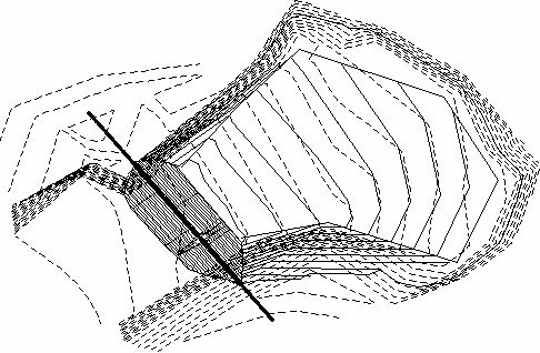
| TOP
OF DAM POLYLINE
|
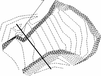
|
|
Existing contours with top of dam polyline |
|
| Valley
Pond showing Emergency Spillway |
Choose method to specify storage elevations
(<Automatic>/Manual)? Enter If manual is selected
the user can specify the elevation(s) to calculate.
Adjust parameters and redesign pond (Yes/<No>)?
Enter If yes, the user will be able to enter new slope
ratios and dam widths etc...
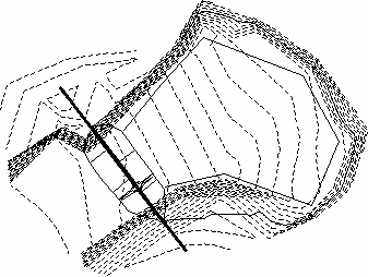
|
|
Valley Pond Design complete with contours
|
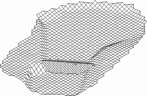
|
| 3D
view of Valley Pond |
Pulldown Menu Location: Surface > Design Pond in
Civil, Structure in Hydro
Keyboard Command: vpond
Prerequisite: Polyline that defines top of dam