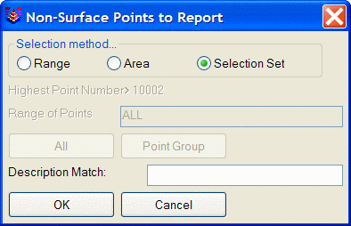
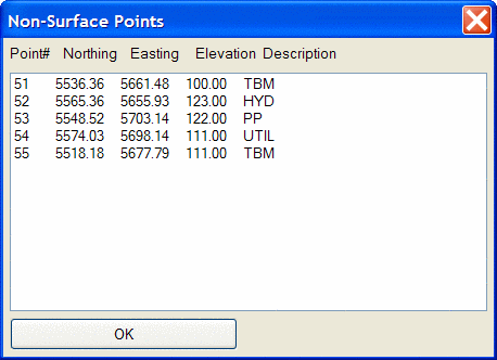
This command allows you to generate a report of Carlson points
in the drawing that have been tagged as non-surface points.
As with tagging and untagging non-surface points, there are several
methods available to select the points for the report, and again,
the points must be present in the drawing to be included in the
report.
Range: This option
allows you to specify a range of point numbers, or select ALL of
the points currently in the drawing, or specify a Point Group,
remembering, however, that only points that are currently in the
drawing can be tagged. So if you select a Point Group, but
only some of the points listed in the Point Group are currently
present in the drawing, the whole Point Group will not be
tagged
Area: This option
allows you to utilize inclusion and/or exclusion polyline(s) to
specify an area in the drawing within which any points currently in
the drawing are tagged as non-surface points.
Selection Set:
This option allows the manual selection of points within the
drawing.
Description Match: This option allows the filtering of selected points by descriptions. For example, you could use a Range of ALL, but set the Description Match to TBM, and only the points with that description would be tagged.
Pulldown Menu Location: 3D Data >> Non-Surface Points
Keyboard Command: tagns
Prerequisite: Carlson points in a drawing