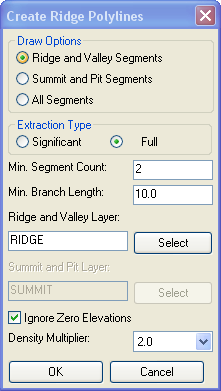
Extraction Type
(Significant and
Full):
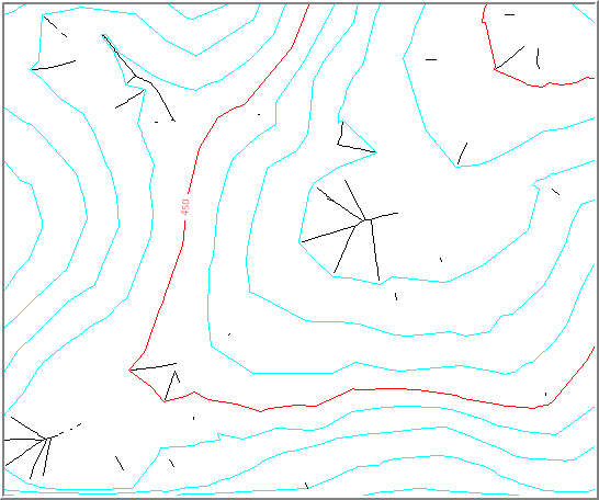
Significant segments are those
segments that fall into relatively flat areas of the triangulation
(large open spaces between the contours). Use this setting to
reduce the number of segments generated by this command. Full
extraction will model all segments.
Minimum Segment Count and Branch Length: Use this setting to prevent small
segment branches from being generated. This can reduce the
occurrence of errors in the output.
Density Multiplier:
The quality of output produced
by this command is directly proportional to vertex density of
contour polylines. This multiplier can be used to temporarily
increase contour vertex density for the duration of calculations at
the cost of additional processing time. Setting this multiplier to
higher values generally reduces occurrence of errors in the
output.
Ignore Zero Elevations: select this to
ignore linework set at zero elevation.
Pulldown Menu Location: 3D Data
Keyboard Command: cs_extract
Prerequisite: Contours with ridges and valleys