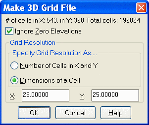
This command creates a distance grid file where the value of
each grid corner is set to the distance to the nearest data point
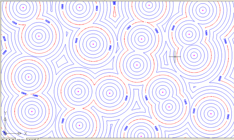
in a drillhole. This is useful to see the distance between
drillholes when planning additional drilling. The grid can be
contoured, as shown below, for better analyzing. The grid
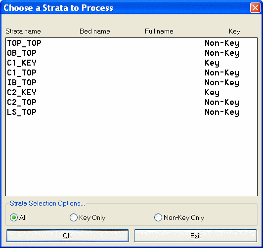
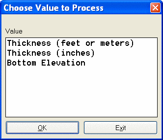
dimensions are set first, then two dialogs appear to select the
strata to grid, and the attribute to grid.
Pick Lower Left limit of
surface area <1.45355e+006,1.96843e+006>:
Pick Upper Right limit of surface area
<1.46712e+006,1.97763e+006>:
Ignore zero values [<Yes>/No]? N
Select drillholes, channel samples and strata polylines.
Select objects: all
129 found
Select objects:
Reading drillhole 129
Finding splits ...
Finding pinch out ...
Calculating seam stacking ...
Writing grid file C:\DRAWINGS\\GRIDS\Nearest Data Points.grd
...
Pulldown Menu Location: StrataCalc
Keyboard Command: distgrid