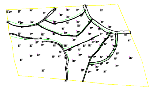
This command creates closed polylines that represent the fault
heave zones where the material is broken up and not mineable. These
polylines can then be used as exclusion areas in routine like
Strata Isopach maps to avoid contours in those areas. They can also
be tagged as Strata Limit Polylines for exclusion for volumes and
to delete the area in a Fence Diagram.
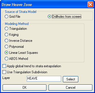
Here are the prompts when using
the drillholes.
Command: draw_heave_zones
Select fault polylines to process:
Select objects: Specify opposite corner: 9 found
Select drillholes, channel samples and strata polylines.
Select objects: all
101 found
Reading drillhole 101
Select the strata limit polylines or ENTER for none.
Finding splits ...
Processing only strata with beds.
Use position from another file or pick grid position
[<Pick>/File]?
Pick Lower Left grid corner:
Pick Upper Right grid corner:
Weighting factor to which power
[First/<Second>/Third/Other]?
Strata Name: V_KEY
Calculating grid by linear least squares 2601...
Pulldown Menu Location: StrataCalc
Keyboard Command: draw_heave_zones
Prerequisite: Drillholes