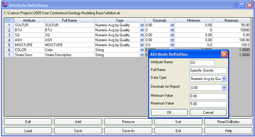
This command defines the full name, value range and value type
of attributes. This allows StrataCalc commands to identify invalid
attributes that fall outside the minimum and maximum value range.
Incorrect data entry is detected in Place Drillhole and
Drillhole Data Sheet. Use the Attribute Validation Report
command under Drillhole, to detect invalid attributes in the
existing drillholes.
This routine also defines the data type as numeric or strings.
Strings are for non-numerical attributes such as color name. String
attributes need to be defined as such before importing the
drillholes, otherwise the attribute values, such as green or red,
will not import correctly.
For numeric attributes, there are settings to Average By
Quantity or Average By Area which apply to Surface Mine Reserves for calculating
the average attribute values. The default is to average by quantity
which uses the strata quantities to calculated the weighted
average. The average by area method uses the strata area as the
weighting factor for the average. The average by quantity applies
to attributes that you want to average by the strata volume such as
BTU. For example, when the strata is thicker who pick up more
quantities and the attribute value in these thicker areas should be
weighted more. The average by area applies to attributes that count
for the presence and not their volume. For example, for an
attribute of thickness, you should average by area.
The Number of Decimal Places is used in the Draw Drillhole Text command and for the reports in Surface Mine Reserves. The attribute definitions are stored in a file with an .ATR extension.
Pulldown Menu Location: Drillhole
Keyboard Command: attrdef