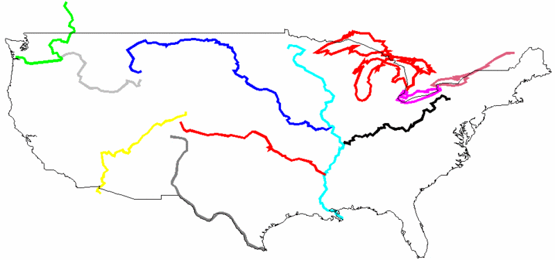
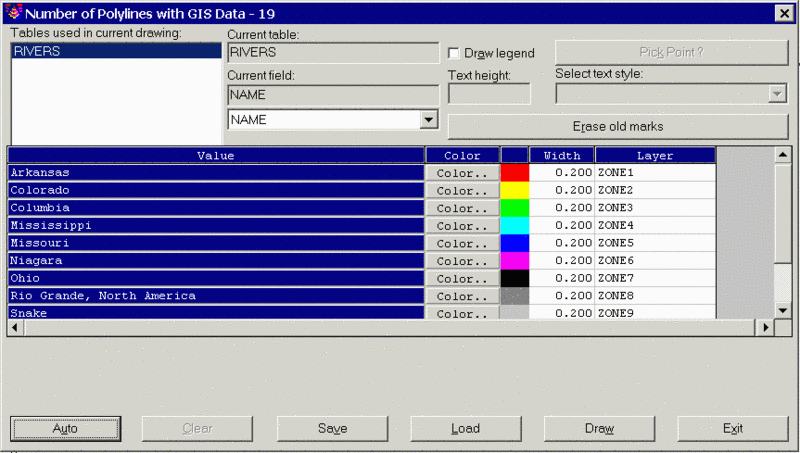
This command draws new polylines as markers along selected existing polylines. The new polyline markers are drawn with width and color based on a query of the attached GIS data. The program starts by selecting open or closed polylines in the drawing with GIS data. Then a dialog appears for specifying the database field to process. This dialog displays a list of all the GIS table names found in the selected polylines. First choose a table to process and then choose a field to process. Next you can specify the color and width for each data value. The Auto button can be used to quickly fill out the color and widths. The Show All The Distinct Values option chooses between processing as series of ranges or individually for each data value.
The Draw Legend option will create a legend of the marks. The Erase Old Marks button will erase any existing polyline markers from the selected polyline. The settings can be saved to and recalled from a GIS settings file (.GSF) using the Save and Load buttons. Once all the settings are ready, pick the Draw button to draw the marker polylines.
Pulldown Menu Location: GIS
Data
Keyboard Command:
trace_polyline
Prerequisite: Closed polylines with
linked GIS data