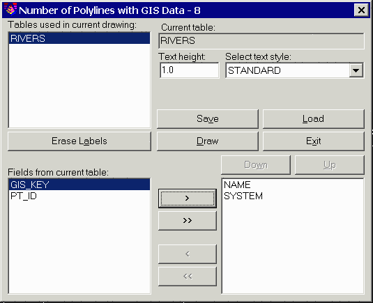
This command draws text labels for the specified fields along the selected polylines with attached GIS data. The program starts by selecting polylines in the drawing with GIS data. Then a dialog appears for specifying the fields to label. This dialog displays a list in the upper left of all the table names found in the selected polylines. First choose a table to process. Then the fields defined for this table are displayed in the lower left list. To add a field to the label, highlight the field name and pick the > button. The fields names in the lower right list are the fields to be labeled in order. Use the Up and Down buttons to change the field order. The Erase Labels option will erase any existing field labels for the selected polylines. The settings can be saved to and recalled from a GIS settings file (.GSF) using the Save and Load buttons. Once all the settings are ready, pick the Draw button to create the labels. The labels are drawn along the polylines.
|
|
|
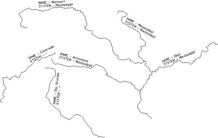
Example of text labels along polylines with GIS data |
Pulldown Menu Location: GIS Data > Label GIS Data
Keyboard Command: label_arc_text
Prerequisite: Polylines with linked GIS information