Label GIS Point Data
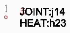
This command labels attributes for point features. The labels
can be drawn as text entities or as blocks with attributes. Before
running this command, use the Define GIS Features command to define
the GIS point features and the attributes.
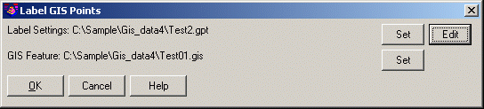 This command starts with a dialog to
set the Label Settings file (.gpt) and the GIS Features file
(.gis). The Label Settings file is used only for this command. Pick
the Edit button to access the editor for the label settings.
This command starts with a dialog to
set the Label Settings file (.gpt) and the GIS Features file
(.gis). The Label Settings file is used only for this command. Pick
the Edit button to access the editor for the label settings.
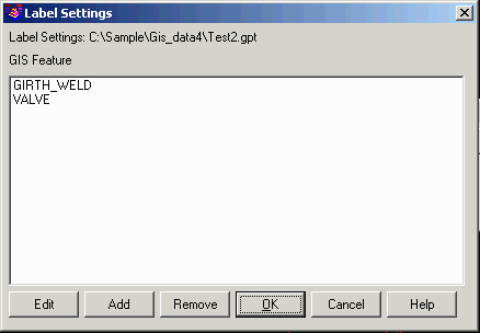 The Label
Settings dialog shows a list of the features with defined labels.
Use the Edit, Add and Remove functions to manage the list.
The Label
Settings dialog shows a list of the features with defined labels.
Use the Edit, Add and Remove functions to manage the list.
 The Edit and
Add functions bring up the label editor dialog.
The Edit and
Add functions bring up the label editor dialog.
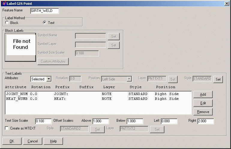
Feature Name: This name needs to match the feature name for
the points as set by Define GIS Features.
Label Method: This settings chooses between creating text labels or
blocks with attributes.
Block Labels
Symbol Name: This is the block drawing name. This drawing
must have block attributes defined for filling out with the GIS
attribute values.
Symbol Layer: The blocks will be drawn on this layer.
Symbol Size Scaler: Controls the size of the blocks.
This size is multiplied by the current drawing horizontal scale to
set the block size.
Custom Attributes: This function has another dialog for mapping the
GIS attributes to the block attributes.
Text Labels
Attributes: Chooses whether to label all the attributes or
specific attributes. When using All, there is one set of settings
for the Rotation, Position, Layer and Style for all the labels. For
using Selected, there is a list of the attributes to label and the
Add, Edit and Remove buttons are used to manage the list.
Text Size Scaler: Controls the size of the text
entities.
Offset Scalers: Control how far to offset the labels from
the point.
Create as MText: This groups all the labels into a single
MText entity instead of individual Text entities for each
attribute.
Prompts
Label GIS Points dialog
Select points to label.
Select objects: pick Carlson points
Pulldown Menu Location: GIS Data > Label GIS Data
Keyboard Command: labgispt
Prerequisite: Carlson points with GIS attributes, Define GIS
Features (.gis) file