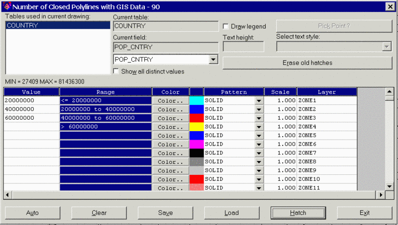
This command hatches closed polylines with attached GIS data based on the value of a specified database field. The program starts by selecting closed polylines in the drawing with GIS data. Then a dialog appears for specifying the database field to process. This dialog displays a list of all the GIS table names found in the selected polylines. First choose a table to process and then choose a field to process by clicking on the down arrow underneath Current field. Next you can specify the color, hatch pattern and layer for each zone. The Auto button can be used to quickly fill out the hatch zones. The Show All The Distinct Values option chooses between processing as series of ranges or individually for each data value. Applications include hatching all commercial property red and residential yellow, coloring buildings by type of construction material, coloring properties by type of ownership, etc.
The Draw Legend option will create a legend of the hatch zones. The Erase Old Hatches button will erase any existing hatches inside the selected polylines. The settings can be saved to and recalled from a GIS settings file (.GSF) using the Save and Load buttons. Once all the settings are ready, pick the Hatch button to hatch the polylines. When using solids for the hatch pattern, the Solid Fill Float command in the View menu can be used to make the polylines appear on top of the solids.
Select objects: select closed polylines with GIS data
|
|
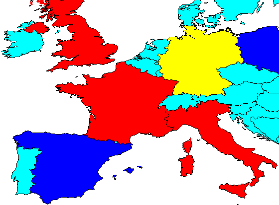
| Example country polylines hatched by population range field |
Pulldown Menu Location: GIS
Data
Keyboard Command:
hatch_polygon
Prerequisite: Closed polylines with linked GIS data