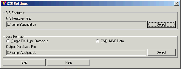
This command sets the current GIS Features and GIS Data Format.
The GIS Features file (.GIS) defines the GIS features and the
attributes for each feature. This file is set by the Define GIS
Features command.
The Data Format defines where the GIS data will be stored. For
Single File Type Database, the data is stored in an external
database in either SQLite format (.DB) or MicroSoft® Access (.MDB).
The Esri MSC Data stores the GIS data within the drawing file in a
format that both Carlson and Esri use. Starting with ArcGIS 9.3,
Esri added support for MSC which makes the DWG file a type of
geodatabase with the feature definitions, GIS data and geometry all
stored in the file.
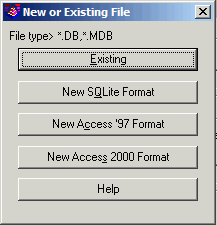
GIS Setting dialog Click both file buttons and select new or existing files.
 Pulldown Menu Location: GIS Data
Keyboard Command:
gis_config
Prerequisite: None