The Identify Map Features command displays the available data from a select map service that has been placed into the drawing. Not all map services support the review of data. also the data that is displayed will vary depending on the map service and the layers selected. After selecting the command you will be prompted to select the map service you want to work with.
Select Map Service: Select the frame of the map you want to identify features for.
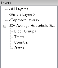
The url for your map service is linked to the frame of the map displayed in CAD. By selecting the image frame the service is connected. The available layers to review are displayed
Select a layer to review by left clicking it. The following command prompt allows you to select the area of interest in the Map.
<Alt> Point/First corner/Identify
Entity <Current view>: Use
<ALT> Point to pick a single point with a prompt for the
second point of a window.
Or in CAD select a first corner by left clicking in an open
area.
Or in Cad select an entity by left clicking on it. Circles, Arcs
and splines are not supported.
Or press the enter key or Right click to use the current
view.
After selecting an area the Identified Features within the area are displayed. Highlighting a feature displays the attributes and values in the right hand pane.
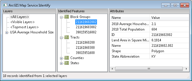
To end the command press the escape key or click the Red X in the ArcGIS Map Services Identify dialog box.
Pulldown Menu Location:
GIS Data > Identify Map
Features
Keyboard
Command: eagmsIdentify
Prerequisite: Map Service inserted in drawing that supports
feature data.