This command creates the Feature/Attribute data structure, or
schema, for GIS functionality. The structure is stored in a
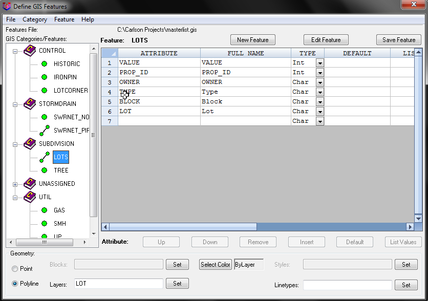
special Carlson file with a (.GIS) file extension. A feature,
such as a manhole, can have multiple attributes, such as Number of
rungs, Type of material, Number of inlets, etc. Features can be
organized into Categories: Utilities, Roads, Properties. The
Category designation is an arbitrary way of organizing the
features. Features and attributes can be imported from
another Carlson GIS Features file, Field to Finish, Esri MSC data
within the drawing, Trimble FXL or from older Carlson Template
Database MDB files.
Features and attributes can of course also be defined "from
scratch" in the Define GIS Features dialog box.
1) The first field to set is the GIS file you are working
with. Use the File menu to create a new (.GIS) file or open
an existing one for editing.
2) Next, set up one or more Category Names, using the Category menu. GIS feature codes can be categorized (e.g. STRUCTURES, UTILITIES, ROAD FEATURES, etc.). At least one category must be created.
3) Next, define Features, using the Feature menu. e.g. A
category such as UTILITIES might have features such as manholes,
light poles, fire hydrants, water valves, etc.
4) Lastly, define the attributes for the Feature. Each
attribute has:
a) a Name
b) a Full Name, or Prompt
c) a Type - Integer, Character or Real
d) a Default Value - these can be preset, or read from a list of
automatically generated values using the Default button
e) optionally, a List of values to pick from. Use the List
Values button to build a list
f) whether the attribute is required
g) whether the attribute Value can be field Edited, appears as Read
Only, or is Hidden
h) whether the value used is restricted to the list
 Geometry Settings
Pulldown Menu Location: GIS Data
Keyboard Command: def_template
Prerequisite: None