
This command captures point data (Number, Northing, Easting,
Elevation, Description) from Carlson Points at the ends of existing
linework and writes that data to a table in the Output
database. If the selected linework has no GIS data already
attached, the following dialog is displayed:
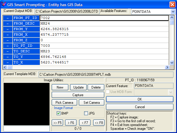
If any of the selected linework has
GIS data already attached, the following dialog is
displayed:

In either case, you are asked to
specify what table is to be used to store the point data.
Once accomplished, using Input/Edit GIS data displays the point
data now associated with the linework.
Pulldown Menu Location: GIS
Data > Data Capture
Keyboard Command:
gisptdata2linework
Prerequisite: Linework and
Carlson Points