Best Fit Transformation is used to transform the coordinates in the
current coordinate file using a “rubber sheet” method of
transformation.
First the user must .
Add points from the coordinate
file. (Enter when done) [All/Block/Code/Desc/Elev/Pt-group/Limits/Radius/Select]:
specify which points are to be transformed using one or more of the
available selection methods.
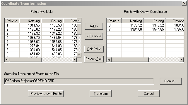
Next, in the Coordinate
Transformation dialog the user must choose at least 2 points
in the coordinate file that are known (or “fixed”) points
To specify a fixed point, highlight it in the Points Available list then press the
Add > button to copy it
to the Points with Known
Coordinates list on the right. Or, if you wish, you can also
specify a known point from the drawing by clicking the Screen Pick button and picking a point
from the screen or typing a point ID at the command line. After
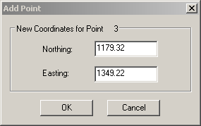
choosing a known point, the following dialog will appear:
The Add Point dialog allows you to change
the current coordinates of the known point or accept the current
coordinates. When done specifying the coordinates of the
known point, click the OK
button
After a point has been placed in the Points with Known Coordinates list on
the right, you can edit the values you entered by highlighting the
incorrect point and clicking the Edit Point button. Or, if you
wish, you can remove an incorrect point from the right hand
Points with Known
Coordinates list by highlighting it and clicking the
< Remove button.
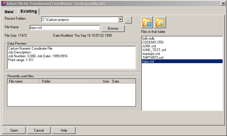
After specifying all the known points, you must specify which
coordinate file will be used to store the transformed points.
If you wish to use the current coordinate file you need do
nothing. If you wish to write the transformed points to a
different coordinate file than the one listed in the Store the Transformed Points in the
File: edit box, click the Browse... button and use the file
dialog (see below) to specify a new or existing coordinate
file. When done choosing a coordinate file, click the
Open button in the file
dialog. Click the Transform button in the Coordinate Transformation dialog to
cause the transformed coordinates to be calculated and stored in
the specified file
Prompts
Add points from the coordinate
file. (Enter when done) [All/Block/Code/Desc/Elev/Pt-group/Limits/Radius/Select]:
specify which points are to be transformed using the typical
C&G Selection method.
Follow the instructions above to fill out the Coordinate Transformation dialog
box.
 Click the Transform button in the Coordinate Transformation dialog to
cause the transformed coordinates to be calculated and stored in
the specified file
Click the Transform button in the Coordinate Transformation dialog to
cause the transformed coordinates to be calculated and stored in
the specified file