 Pulldown Menu Location:
Annotate
Pulldown Menu Location:
AnnotateKeyboard Command: lablat
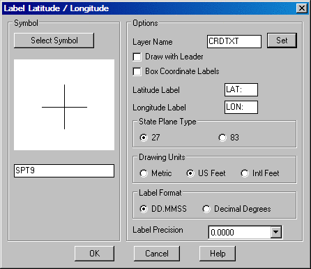
Prerequisite: Define coordinate system in Drawing Setup
This command will label the latitude and longitude of a selected point. The program will convert the northing and easting of the input points to latitude and longitude. The coordinate system for the drawing coordinates must be defined in Drawing Setup before running this command. First, the program displays a dialog box with options to set the label prefixes, to set the display precision, to draw a box around the label and to change the symbol used to mark the point. Then the program prompts for the points to label. As you move the cursor, the program display the latitude/longitude in real-time.
Label Latitude /
Longitude dialog
Pick point or point number: pick a point
Pick point or point number: press Enter to
end
Pulldown Menu Location:
Annotate