 Pulldown Menu Location: 3D
Data
Pulldown Menu Location: 3D
DataKeyboard Command: surfpl
Prerequisite: Existing surface file
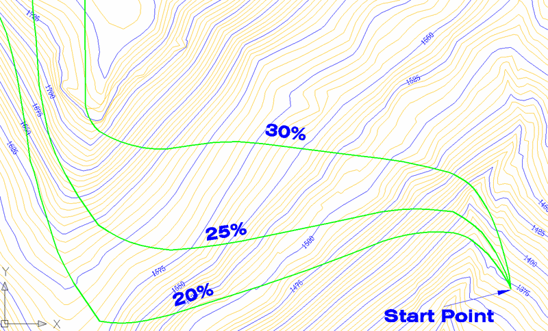
This command creates a 3D polyline at a user-specified slope. The user picks the starting point and then the polyline continues along the surface at the slope until it reaches a point where the maximum slope at the point is less than the design slope. The surface is defined by a grid or TIN file which must be created before running this routine. Applications for this command include designing haul roads or ditches.
Enter the polyline layer <SLOPE_ROAD>: press
Enter
Select the Grid File dialog
Reading row> 51
Extrapolate grid to full grid size (Yes/<No>)?
Y
Limiting length for polyline
(Enter for none):
Pick origin point of 3D polyline: pick a starting
point
Direction of 3D Polyline (<Up>/Down)? press
EnterThe slope must go either uphill or downhill.
Direction of 3D Polyline facing up slope
(<Left>/Right)? R Imagine facing uphill. Do you
want the polyline to go to the left or right?
Enter the design slope: 10 This value is in percent
slope.
Pulldown Menu Location: 3D
Data